
查看原文全部插图(11 幅)






内容提要
本文介绍了位于休伦湖畔的莱斯切诺群岛,探讨了其独特的冰川地貌特征及其对当地生态与文化的影响。这些岛屿的形成与末次冰期有关,并展现了该地区丰富的地质历史与航海文化。
原文全文译文
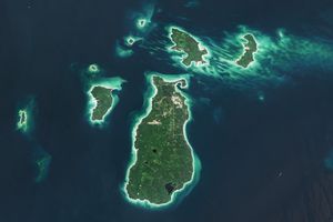
只需一眼望向休伦湖(Lake Huron)岸边一段12英里的区域,就能清晰地发现一种模式。被棕褐色沙滩和明亮浅水勾勒出轮廓的小岛,以一种极其平行的方向排列着。这种如同爪痕般的外观在这一图像中显而易见,该图像由美国国家航天局(NASA)与美国地质调查局(USGS)的Landsat 9卫星上搭载的陆地成像仪(OLI)于2026年7月拍摄。
With one glance at a particular 12-mile stretch of Lake Huron’s shoreline, it’s clear there’s a pattern. Small islands outlined by tan beaches and bright, shallow water align in a remarkably parallel orientation. The claw-mark-like appearance of this Great Lakes locale is evident in this image, acquired with the OLI (Operational Land Imager) on the NASA-USGS Landsat 9 satellite in July 2026.
莱斯切诺群岛(Les Cheneaux Islands)是位于密歇根州上半岛(Upper Peninsula)附近的一组36个岛屿,位于麦基诺海峡(Straits of Mackinac)东北约20英里(32公里)处。该群岛包含沿海沼泽、岩石和沙滩、泥炭沼泽,以及长满松树和雪松的森林。部分岛屿被划为自然保护区,其中包括马凯特岛(Marquette Island)的很大一部分,该岛只能乘船或经由冰面抵达。这些岛屿间散布着受遮蔽的水域,这也是其名称的由来;法语“Les Cheneaux”大致翻译为“水道”。
The Les Cheneaux Islands are a group of 36 islands near the shore of Michigan’s Upper Peninsula, about 20 miles (32 kilometers) northeast of the Straits of Mackinac. The archipelago contains coastal marshes, rock and sand beaches, peat bogs, and forests full of pine and cedar. Parts of several islands are set aside as nature preserves, including a substantial portion of Marquette Island, which is only accessible by boat or over ice. The islands are interspersed with sheltered waters that inspired their name; the French “Les Cheneaux” roughly translates to “the channels.”
莱斯切诺群岛与五大湖地区的许多地貌一样,其外观是由于威斯康星冰期(Wisconsin Ice Age)的冰川在约10,000年前消退时雕琢而成的。它们细长的形状表明其中许多是鼓丘:与冰川运动方向平行的冰川碎屑堆。
The Les Cheneaux Islands, like many landforms in the Great Lakes region, look the way they do because glaciers of the Wisconsin Ice Age carved the landscape as they retreated around 10,000 years ago. Their elongated shapes indicate many of them are drumlins: mounds of glacial debris that run parallel to the direction of the ice’s movement.
冰川地形促成了独特的当地海洋文化。与五大湖广阔的开阔水域相比,莱斯切诺群岛周围的水域相对受到保护,免受可能搅动中西部北部湖泊的恶劣风暴影响。这为划桨运动以及在安静的小海湾中垂钓小口黑鲈、白斑狗鱼、黄鲈和湖鳟等鱼类创造了机会。锡达维尔(Cedarville)镇以一年一度的古董木船展、造船学校以及展示从该地区最早的居民到今天的居民如何利用这些岛屿和水道的博物馆而闻名。
The glacial topography has helped give rise to a distinct local maritime culture. In contrast with the Great Lakes’ vast open expanses, the waters around the Les Cheneaux Islands are relatively protected from the infamous storms that can otherwise roil the upper Midwest lakes. This creates opportunities for paddling, as well as fishing in quiet alcoves for species such as smallmouth bass, northern pike, yellow perch, and lake trout. The town of Cedarville boasts an annual antique wooden boat show, a boat-building school, and museums highlighting how people, from the area’s earliest inhabitants to today’s residents, have used the islands and waterways.
在陆地上,该地区更古老的地质结构在几个色彩鲜艳的采石场中显露出来。这里的基岩是白云岩,一种变质的石灰岩。它是在400多百万年前的志留纪(Silurian period)沉积于浅海热带海域,随后板块运动将其带到了北方。密歇根州拥有几个大型白云岩和石灰岩矿,位于锡达维尔以东的白云岩港(Port Dolomite)每年运输数百万吨这种材料。
On land, the much older geology of the area is revealed in a couple of brightly colored quarries. The bedrock here is dolomite, a modified form of limestone. It was deposited in the Silurian period more than 400 million years ago in a shallow, tropical sea before the movement of tectonic plates brought it up north. Michigan is home to several large dolomite and limestone mines, and Port Dolomite, east of Cedarville, ships millions of tons of the material every year.
图注:美国国家航天局地球天文台(NASA Earth Observatory)图像,由Lauren Dauphin制作,使用了美国地质调查局的Landsat数据。故事由Lindsey Doermann撰写。
NASA Earth Observatory image by Lauren Dauphin, using Landsat data from the U.S. Geological Survey. Story by Lindsey Doermann.
参考文献与资源
References & Resources
- Aldo Leopold Festival (2021) Les Cheneaux Geology Tour. Accessed August 20, 2026.
- Aldo Leopold Festival (2021) Les Cheneaux Geology Tour. Accessed August 20, 2026.
- Les Cheneaux Historical Association (2026) Welcome to The Les Cheneaux Historical Association. Accessed August 20, 2026.
- Les Cheneaux Historical Association (2026) Welcome to The Les Cheneaux Historical Association. Accessed August 20, 2026.
- Les Cheneaux Islands Chamber of Commerce (2026) Visitor Information. Accessed August 20, 2026.
- Les Cheneaux Islands Chamber of Commerce (2026) Visitor Information. Accessed August 20, 2026.
- National Park Service (2018, February 22) Drumlins. Accessed August 20, 2026.
- National Park Service (2018, February 22) Drumlins. Accessed August 20, 2026.
- Schaetzl, R., 沉积岩(Sedimentary Rock)序列 in the Michigan Basin. Accessed August 20, 2026.
- Schaetzl, R., Sedimentary Rock Sequence in the Michigan Basin. Accessed August 20, 2026.
来源与许可
原文来自公共领域来源;译文由机器生成,请以原文为准。 原作者:Lauren Dauphin。 原始页面