查看原文全部插图(9 幅)



内容提要
随着2026年美国西部积雪干旱的影响持续至夏季,美国国家航天局(NASA)的地球观测数据正被用于机器学习河流预报模型。这些预报为华盛顿州的供水、电力调度及公共安全决策提供了关键支持。
原文全文译文
随着2026年美国西部积雪干旱的影响持续至夏季,美国国家航天局(NASA)的地球(Earth)数据正被用于机器学习预报,为华盛顿州的供水、电力和公共安全决策提供参考。
As the effects of the 2026 snow drought in the western United States carry into summer, NASA Earth data is feeding machine-learning forecasts that inform decisions about water, power, and public safety in Washington state.
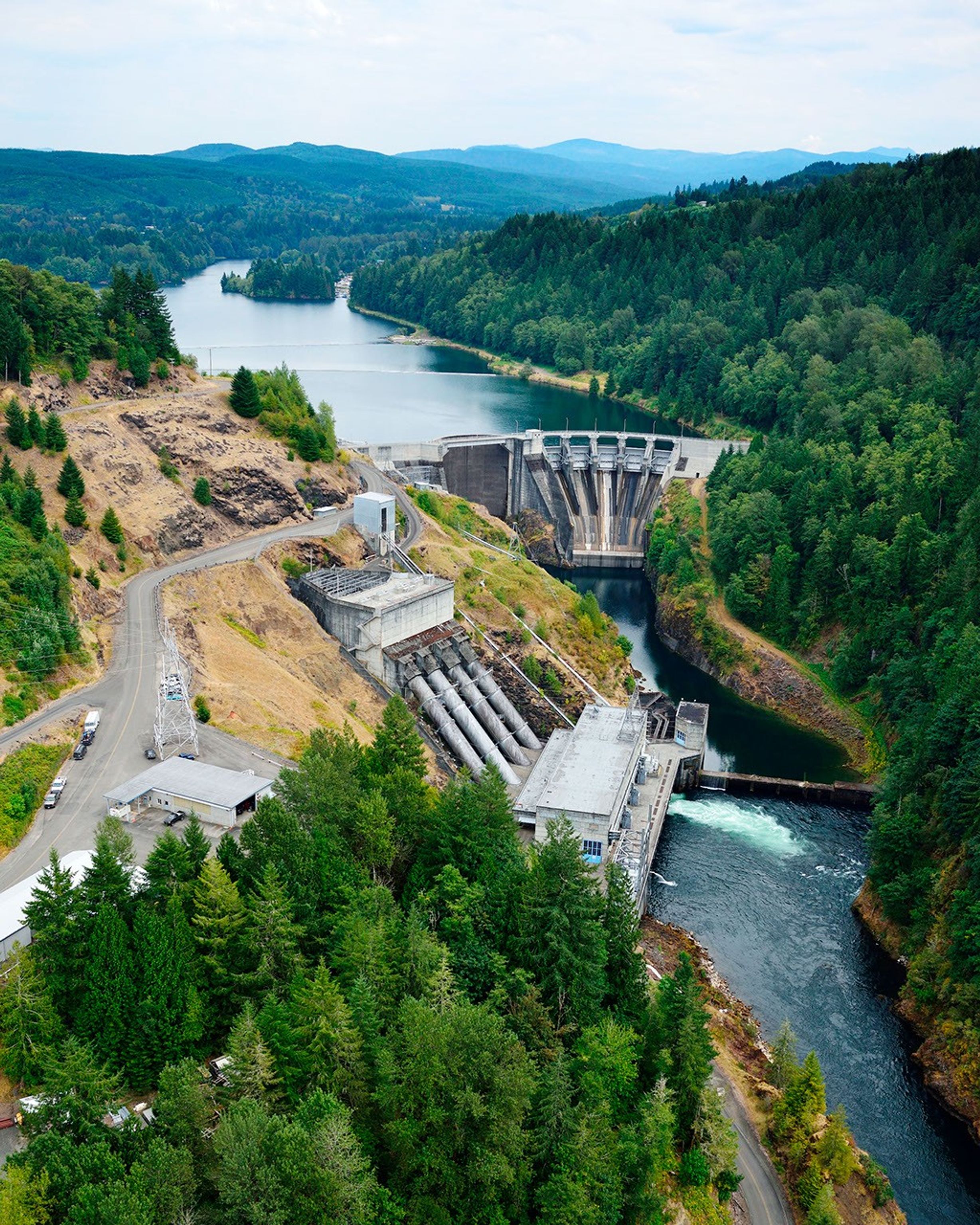
华盛顿州的公用事业公司塔科马电力公司(Tacoma Power),正在利用一家美国科技公司的河流流量预报来应对考利茨河(Cowlitz River)极端的水文年份。该公司最大的水力发电项目利用梅菲尔德(Mayfield)大坝和莫西罗克(Mossyrock)大坝蓄水,每年产生的电力可供超过151,000户家庭使用。
Tacoma Power, a Washington public utility, is using a U.S. technology company’s river-flow forecasts during a year of water extremes on the Cowlitz River. The utility’s largest hydroelectric project uses water stored behind Mayfield and Mossyrock dams to generate enough electricity to serve more than 151,000 homes each year.
Upstream Tech公司的HydroForecast将天气预报和河流测量数据,与NASA生产的关于积雪覆盖和植被状况的卫星(satellite)数据相结合,以预测未来数小时至数日的河流流量。这些预报每两小时更新一次,被水库管理者、水电生产商、水务公司和政府机构用于防范风暴、规划水库泄洪以及应对干旱时期。
Upstream Tech’s HydroForecast combines weather forecasts and river measurements with NASA-produced satellite data on snow cover and vegetation conditions to predict river flow from hours to days ahead. Updated every two hours, the forecasts are used by reservoir managers, hydropower producers, water utilities, and government agencies to prepare for storms, plan reservoir water releases, and navigate dry periods.
“NASA的任务之一是让来自太空的视角在地面上发挥作用,”NASA华盛顿特区总部水资源项目经理Erin Urquhart表示,“当一家美国公司将NASA免费提供的数据整合到预报中,帮助水务管理者防洪、发电和管理水资源时,这就是NASA在为国家创造实际价值。”
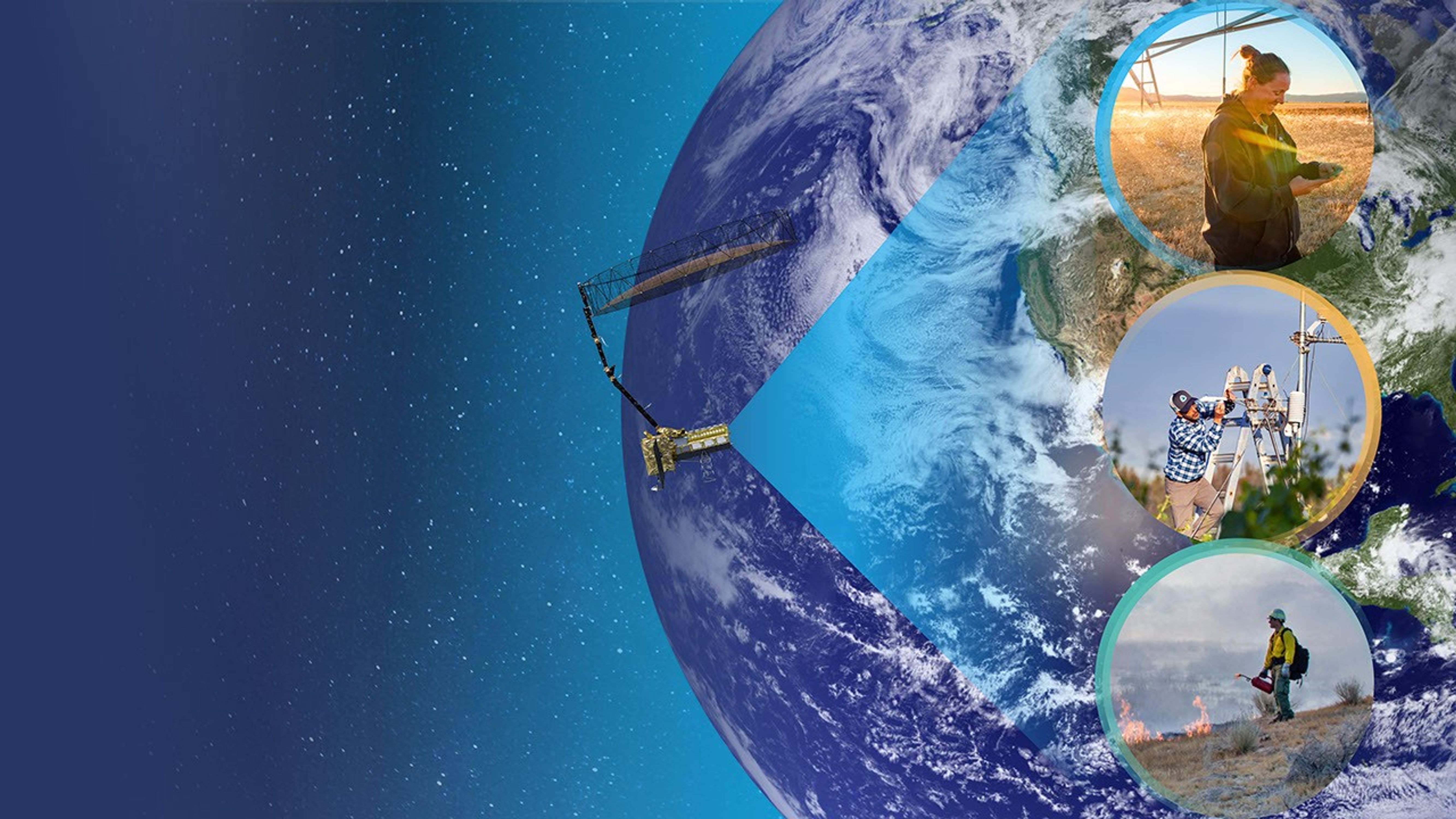
“Part of NASA’s mission is to make the view from space useful on the ground,” said Erin Urquhart, manager for NASA’s Water Resources program at the agency’s headquarters in Washington, D.C. “When an American company incorporates NASA’s freely available data into forecasts that help water managers prepare for floods, generate power, and steward water supplies, that’s NASA delivering practical value to the nation.”
极端水文年份
Year of water extremes
在2025-26年冬季,异常温暖的气候意味着美国西部大部分地区的降水更多以雨而非雪的形式出现,而低于正常的降水量加剧了部分地区的缺水状况。根据NASA MODIS(中分辨率成像光谱仪)卫星记录,1月、2月和3月的西部积雪覆盖面积均为自2001年以来的同期最低值。
During the winter of 2025-26, unusual warmth meant a larger share of precipitation fell as rain instead of snow across much of the West, while below-normal precipitation deepened deficits in some areas. January, February, and March each had the lowest Western snow cover for that month in the NASA MODIS (Moderate Resolution Imaging Spectroradiometer) satellite record since 2001.
在考利茨河,这些条件导致了一个极端季节的出现。2025年12月,一股强劲的大气河流(atmospheric river)将一条狭长的太平洋水汽带入该地区,导致塔科马电力公司的水力发电项目记录到了有史以来最大的一次单日入流量激增。整个季节中,这种多雨的模式使水流迅速向下游流去,而不是形成能够融化并稳定向夏季供水的山地积雪。积雪量仅保持在正常水平的20%至50%。
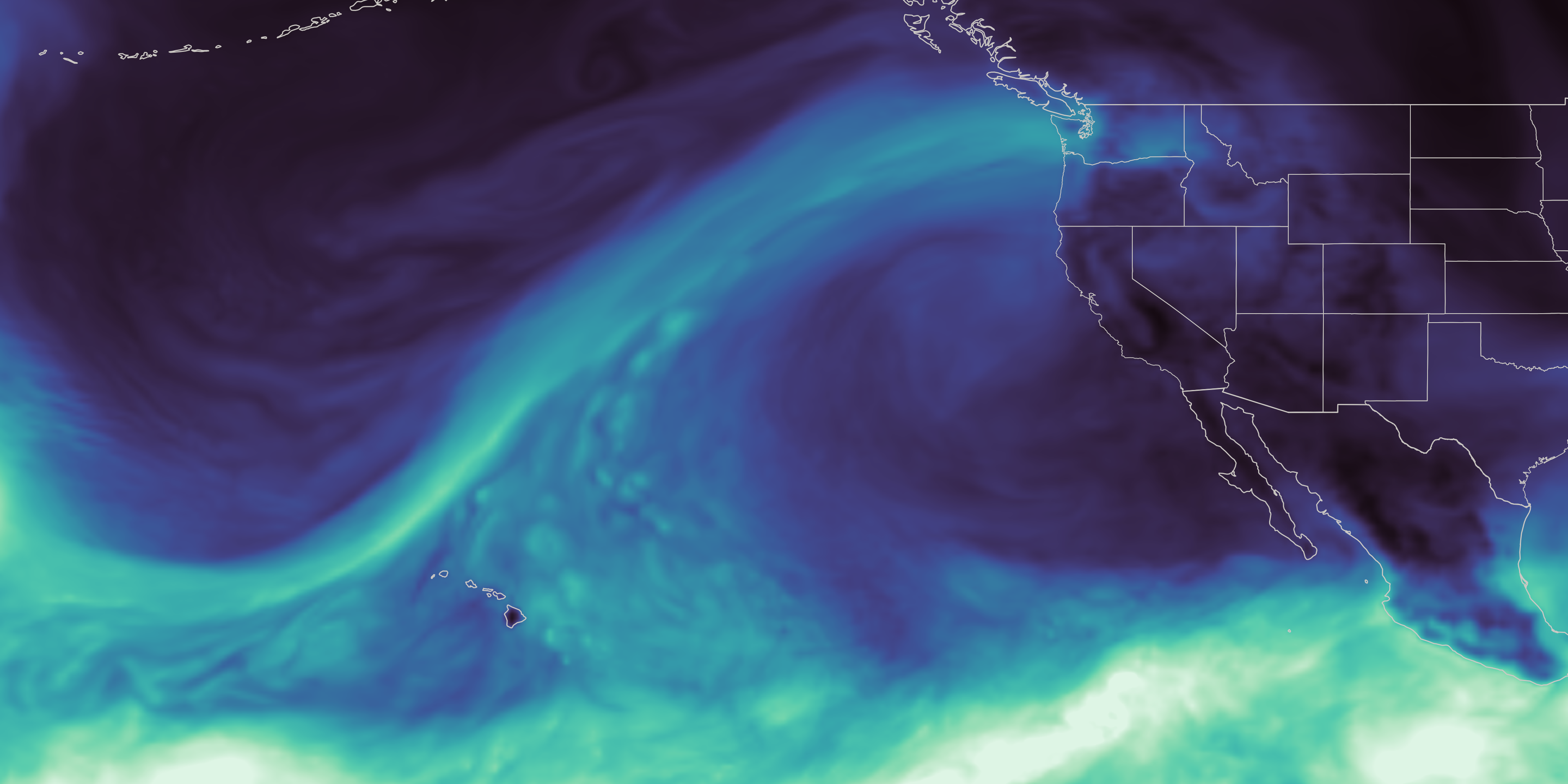
On the Cowlitz, those conditions produced a season of extremes. In December 2025, a powerful atmospheric river brought a long, narrow band of Pacific moisture into the region, causing one of the largest one-day inflow surges ever recorded at Tacoma Power’s hydroelectric project. Across the season, that rain-heavy pattern sent water downstream quickly instead of building mountain snowpack that would melt and release water steadily into summer. Snowpack remained at just 20% to 50% of normal levels.
随着冬季转为春季,降雨逐渐减少。4月8日,华盛顿州将包括考利茨河在内的所有流域列为干旱紧急状态。塔科马电力公司高级水力运营经理Saul Villarreal表示,从4月到6月,该项目的每日峰值入流量处于历史最低水平,导致塔科马电力公司在夏季需求高峰到来前,补充水库的入水量减少。
As winter became spring, the rain tapered off, and on April 8, Washington state placed every watershed, including the Cowlitz, under a drought emergency. From April through June, peak daily inflow into the project was among the lowest on record, leaving Tacoma Power with less incoming water to replenish its reservoirs ahead of summer demand, said Saul Villarreal, Tacoma Power’s senior hydro operations manager.
将卫星数据转化为河流预报
Turning satellite data into river forecasts
NASA将Suomi-NPP(索米国家极轨道伙伴卫星)卫星上的VIIRS(可见光红外成像辐射仪套件)仪器收集的观测数据,转化为能够提供整个流域积雪覆盖和植被绿度信息的数据产品,包括那些地面监测站稀少的地区。
NASA turns observations collected by the VIIRS (Visible Infrared Imaging Radiometer Suite) instrument on the Suomi-NPP (Suomi National Polar-orbiting Partnership) satellite into data products that provide information about snow cover and vegetation greenness across entire watersheds, including where ground monitors are sparse.
为了训练HydroForecast,Upstream Tech收集并存档了多年来这些NASA产品,以及天气预报数据和实际的河流流量测量数据。通过使用数百个流域的记录,模型学习了水在景观中移动的常见模式,并将其应用于新的地点。
To train HydroForecast, Upstream Tech collects and archives years of those NASA products alongside weather forecast data and actual river-flow measurements. Using records from hundreds of watersheds, the models learn common patterns in how water moves through the landscape and apply them in new locations.
Upstream Tech公司HydroForecast技术与联邦合作总监Laura Read博士表示,在多个流域进行的测试发现,纳入积雪和植被观测数据提高了预报的准确性。“NASA的数据为我们提供了所需的可靠性、全球覆盖范围和一致性,”Read说,“我们的短期模型每两小时运行一次,因此这些输入必须在我们需要时及时出现。虽然我们有应急措施,但运营流程的任何中断都是一件大事。”
Tests across multiple basins found that including snow and vegetation observations increased forecast skill, said Dr. Laura Read, director of technical and federal partnerships for HydroForecast at Upstream Tech. “NASA’s data gives us the reliability, global coverage, and consistency we need,” said Read. “Our short-term models run every two hours, so those inputs have to show up when we need them. Though we have stopgaps in place, any interruption to our operational pipeline is a huge deal.”
塔科马电力公司将HydroForecast与流量计、积雪监测站和操作员的判断结合使用。Villarreal表示,在12月的风暴期间,基于NASA数据的短期预报帮助公司预判了进入项目的入水量,并为动态的河流状况做好了准备,同时满足了运营要求并确保了公共安全。
Tacoma Power uses HydroForecast alongside stream gauges, snow stations, and operator judgment. During the December storm, the NASA-informed, short-term forecast helped the utility anticipate how much water would reach the project and prepare for dynamic river conditions, while meeting operating requirements and keeping public safety at the forefront, Villarreal said.
随着春季临近,运营挑战发生了逆转。塔科马电力公司利用HydroForecast的季节性模型来追踪径流减弱带来的日益增长的风险,并开始将水库水位保持在高于平时的水平,以储备夏季用水。这使得容纳另一场大风暴的空间变小,因此操作员继续查看短期预报以“进行防御”,并随时准备在另一场大气河流形成时调整运营。
As spring approached, the operational challenge reversed. Tacoma Power used HydroForecast’s seasonal model to track the growing risk of weak runoff and began keeping its reservoirs higher than usual to preserve water for summer. That left less space to contain another large storm, so operators continued checking the short-term forecast “to play defense,” and remained ready to adjust operations if another atmospheric river developed.
“我们越早了解条件可能发生的变化,就能越有效地规划如何管理水库,并在整个季节平衡我们系统的多种需求,”Villarreal说。
“The earlier we understand how conditions might change, the more effective planning we can do to manage our reservoir and balance the many demands of our system throughout the season,” said Villarreal.
尽管春季干旱,塔科马电力公司在2026年夏季开始时,水库水位仍接近平均水平。储存的水支持了可靠的水力发电、维持鱼类和水生栖息地所需的河流流量,以及公共娱乐活动。它还使公司在热浪或意外停电期间能够更灵活地满足电力需求,并在可能的情况下支持更广泛的区域电力系统。
Tacoma Power entered summer 2026 with reservoir levels near average despite the dry spring. The stored water supports reliable hydropower, required river flows to support fish and aquatic habitat, and public recreation. It also gives the utility more flexibility to meet electricity demand during heat waves or unexpected outages and, when possible, support the wider regional power system.
从预报到干旱评估
From forecasts to drought assessments
塔科马公用事业公司的考利茨水电项目只是NASA科学支持西部水资源决策的一个例子。
Tacoma Public Utilities’ Cowlitz Hydro Project is just one example of NASA science supporting water decisions across the West.
NASA还与美国农业部(U.S. Department of Agriculture)的自然资源保护局(Natural Resources Conservation Service)合作,将基于卫星的积雪和地下水信息纳入机器学习供水预报中。
NASA also has partnered with the U.S. Department of Agriculture’s Natural Resources Conservation Service to bring satellite-based snow and groundwater information into machine-learning water-supply forecasts.
美国国家海洋和大气管理局(National Oceanic and Atmospheric Administration)的科罗拉多河流域预报中心使用MODIS和VIIRS数据来调整其模型中的融雪率。垦务局(Bureau of Reclamation)则使用NASA及其衍生的积雪数据,以及其他来源,用于加利福尼亚州圣华金盆地(San Joaquin Basin)的水库运营。
The National Oceanic and Atmospheric Administration’s Colorado Basin River Forecast Center uses MODIS and VIIRS data to adjust snowmelt rates in its model. The Bureau of Reclamation uses NASA and NASA-derived snow data, alongside other sources, for reservoir operations in California’s San Joaquin Basin.
美国国家航天局(NASA)的数据和研究长期以来一直为美国干旱监测(U.S. Drought Monitor)提供信息,这是农民、水资源管理者和公共机构使用的每周评估报告。NASA于2026年成为正式合作伙伴,将其角色从提供信息扩展到协助制作评估报告。该机构在8月17日当周首次负责撰写了干旱监测报告。
NASA data and research have long informed the U.S. Drought Monitor, the weekly assessment used by farmers, water managers, and public agencies. NASA became a formal partner in 2026, expanding its role from providing information to helping produce the assessment. The agency took its first turn authoring the Drought Monitor during the week of Aug. 17.
来源与许可
原文来自公共领域来源;译文由机器生成,请以原文为准。 原始页面